01The system behind the project
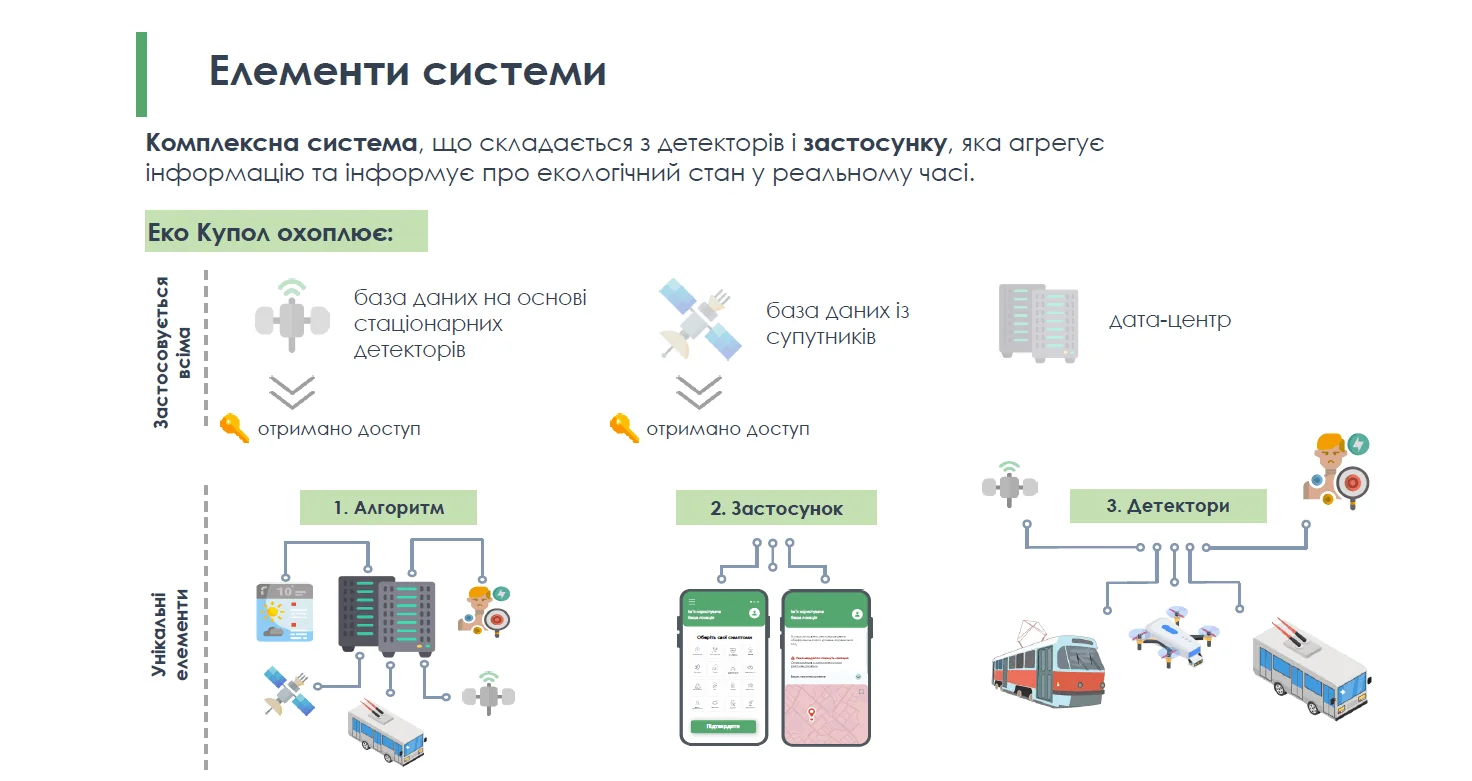
EcoDome is a preliminary air-quality information concept combining fixed and mobile sensors, satellite observations, drones and voluntary symptom reports. It responds to the need for denser, faster and more understandable pollution information, not to the physical reduction of emissions itself. Measurement quality, calibration, privacy, response protocols and the business model remain unvalidated. Because air pollution crosses administrative boundaries, a shared functional monitoring service could support communities across the industrial agglomeration; the source does not evidence agglomeration-wide deployment, regulatory acceptance or a new common authority.
02How the intervention works
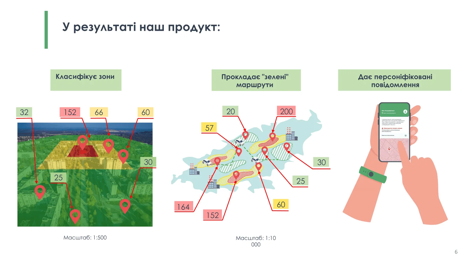
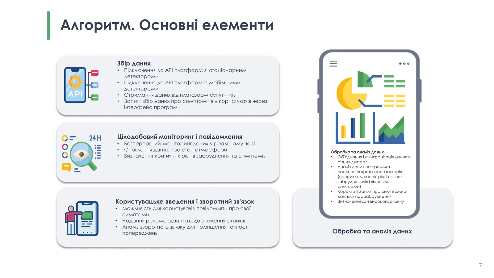
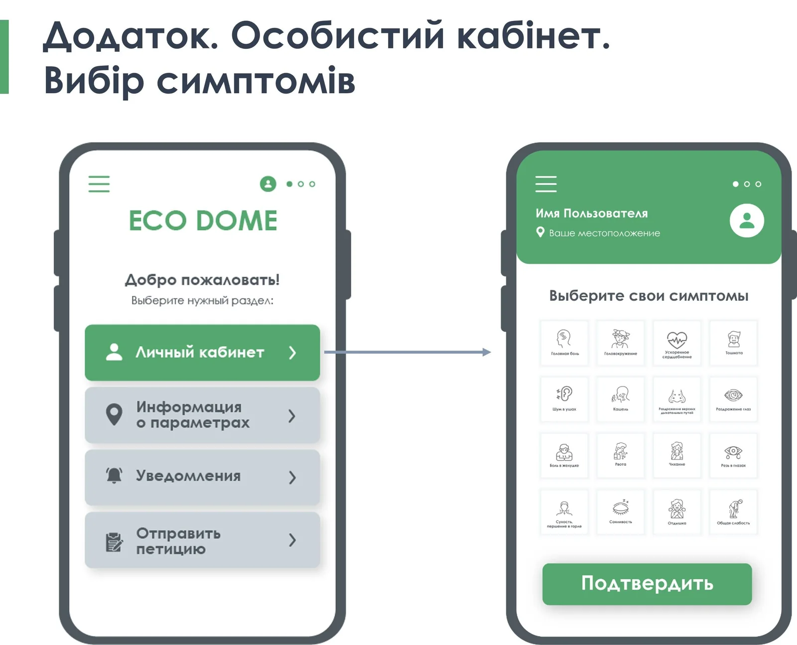
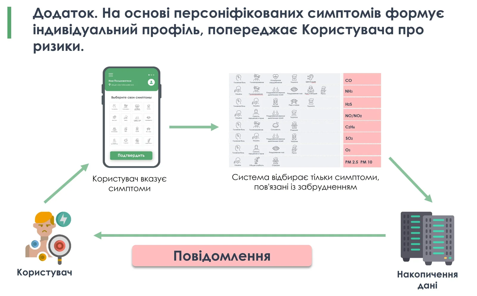
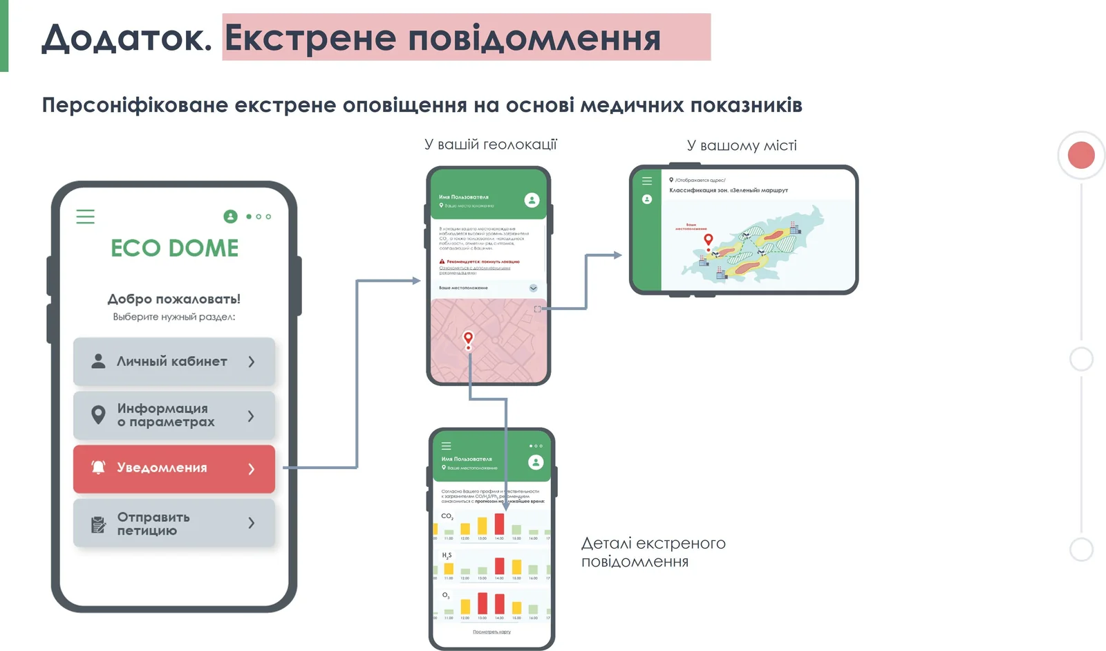
The system should separate measurement, contextual observation and human reports while connecting them through a governed data platform. Fixed and mobile sensors require metadata, siting rules, calibration, quality flags and co-location with reference instruments. Satellite and drone layers need resolution, timing and uncertainty labels; symptom reports need consent, minimisation and aggregation. A geospatial pipeline can produce maps, trends and alerts only after automated and human quality control. Versioned methods, open interfaces, cybersecurity, audit logs and documented escalation protocols must prevent indicative sensor readings from being misrepresented as regulatory measurements.
03From concept to an operable asset
Delivery should start by defining pollutants, decisions, users and response responsibilities, then establish an environmental baseline and access to reference monitoring. A limited pilot should co-locate devices, test communications and power, quantify drift and false alerts, and compare mobile, satellite and fixed layers. Only validated components should expand to additional sites, public dashboards and operational alerts. Response exercises with health, environmental and community users should test whether information is understood and acted upon. The preliminary concept, stated budget and timetable do not evidence procurement, validated measurements, regulatory status, operational deployment or achieved pollution reduction.
04What must be proven before commitment
Technical, ethical and commercial due diligence must verify sensor specifications, detection limits, calibration and maintenance frequency, reference-network access, siting representativeness, communications resilience and data completeness. Reviewers should test quality algorithms, uncertainty display, alert thresholds, false-positive handling and the separation of symptom reports from pollution measurements. Drone compliance, geospatial and satellite licences, privacy, consent, cybersecurity, data retention, public communication and liability require explicit controls. Operating costs, replacement cycles, staffing, service ownership, customer need and revenue assumptions must be validated before scaling or presenting outputs as decision-grade evidence.
05Where a partner can create value
The project needs atmospheric scientists, accredited air-quality laboratories and sensor integrators capable of reference co-location, calibration, uncertainty analysis and field maintenance. GIS, earth-observation and data-engineering partners should manage provenance, spatial resolution, quality flags and open interfaces. Cybersecurity and privacy specialists are essential, particularly for location and voluntary health information. Municipal site hosts can provide secure power and access without implying a common authority. Environmental and public-health practitioners should design response protocols, while community communicators test understandable alerts. Independent validators and sustainable service operators must be able to audit performance, maintain devices and publish limitations transparently.